


Community groups are rallying in opposition to six proposed development schemes in the Belrose/Frenchs Forest and Oxford Falls area where land owned by the Metropolitan Local Aboriginal Land Council (MLALC) is being earmarked for housing development and other facilities.
Objections raised involve a variety of concerns, including: threats to wildlife from an increase in domestic cats and vehicular traffic; damage to native habitat from pollution run-off; limited infrastructure to cater to the thousands of new residents; bushfire risks; and the vulnerability of Aboriginal heritage sites.
MLALC own nine sites totalling 912 hectares in the Northern Beaches Local Government Area, of which six sites (three in Belrose, two in Frenchs Forest, one in Oxford Falls) have been identified by NSW Dept Planning for development.
In February 2022, MLALC chief executive Nathan Moran told The Urban Developer, “This is an extremely positive step towards utilising our land to deliver economic outcomes for our community, as envisaged by the Aboriginal Land Rights Act.”
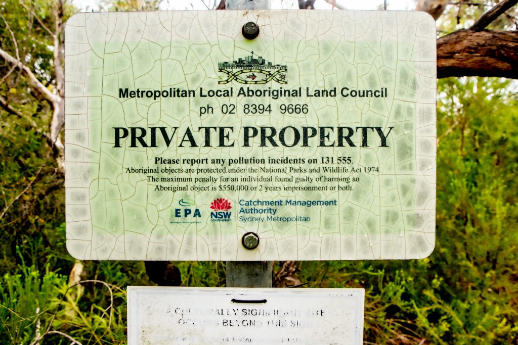
MLALC, based in Redfern in south-central Sydney, and formerly known as the Redfern Land Council, is an incorporated body constituted under the 1983 Aboriginal Lands Right Act (ALRA).
ALRA was enacted in June 1983 by the NSW Govt under Labor Premier Neville Wran, to provide a way of compensating Aboriginal people for loss of their land since British colonisation of Australia in 1788.
It allowed Aboriginal land councils to seek possession of empty Crown land deemed not necessary for essential public purposes as well as claim freehold title over some Aboriginal reserves.
However, there was no statutory recognition of traditional ownership nor processes to claim former Aboriginal reserves.
According to MLALC’s website, their “Land Rights Unit researches and makes claims on vacant crown land within Metro’s boundaries of the greater Sydney metropolitan area. This work has enabled Metro to become the largest single landholder in a number of Sydney local government areas.”
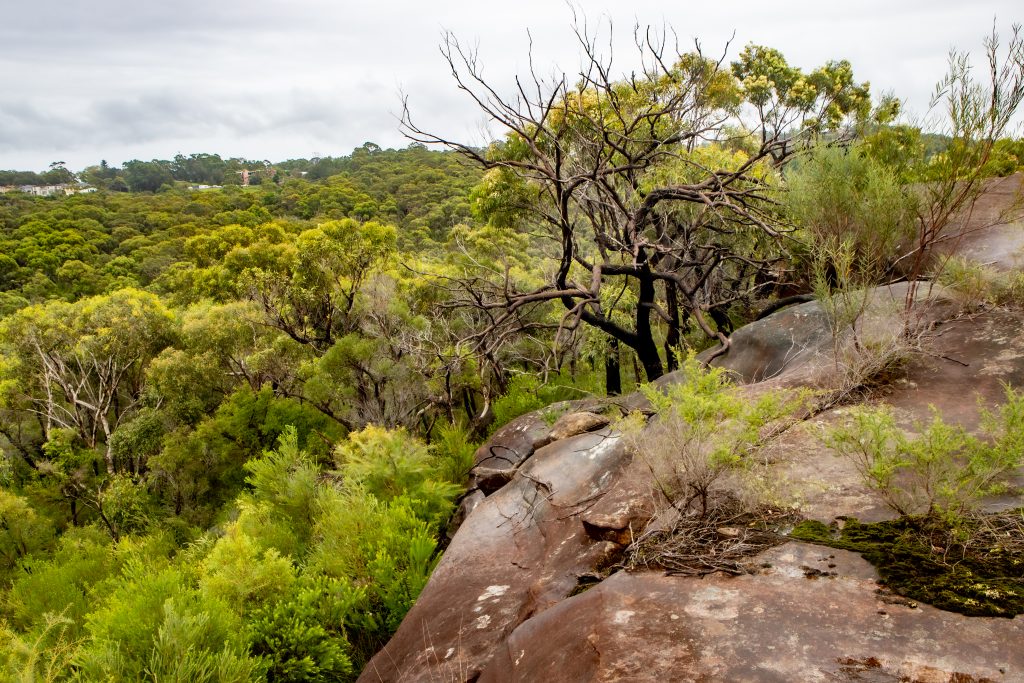
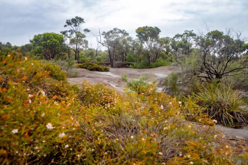
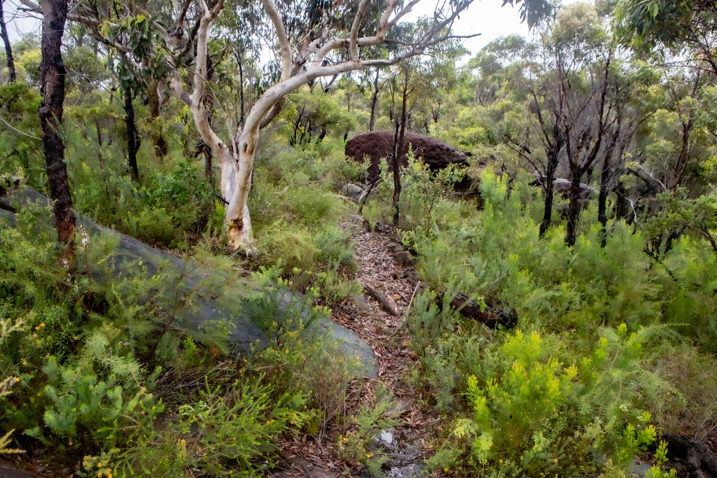
One of MLALC’s six sites up for redevelopment, the 71-hectare zone encompassing Lizard Rock on Morgan Rd in Belrose, has been chosen for a 450 home subdivision. A similar application to rezone and develop this region was rejected in November 2006, mainly for environmental reasons, by Warringah Council (before they were amalgamated into Northern Beaches Council).
If the new submission is approved, surrounding residents believe site clearance work could begin before the end of 2022.
However, a Department of Planning and Environment spokesperson told Manly Observer, “If approved, the DDP would not allow building to commence this year as stated in the media enquiry. A proposal to change planning rules for the site would need to be lodged, assessed and approved. Only then could development applications be lodged. These processes allow for further community consultation.”
The remaining five sites, some of which may be considered for recreation or sporting facilities as well as residential dwellings, are situated at Forest Way, Belrose; Ralston Avenue, Belrose; Aquatic Drive, Frenchs Forest; Paxton Street, Frenchs Forest; and Corymbia Circuit, Oxford Falls.

Objections
The proposed developments have initiated dozens of discussions across social media, including the Belrose, Davidson, French’s Forest & Forestville Community Page, the Bare Creek Bike Park Community Page, Trail Care, Save Manly Dam Bushland, Friends of Narrabeen Lagoon Catchment, Save Oxford Falls Valley, Save Northern Beaches Bushland, and the newly-configured Northern Beaches Aboriginal Land Community Discussion Group (created specifically to discuss the development proposals), all on Facebook.
On 25 February, Save Manly Dam Bushland posted, “In the Narrabeen Lagoon catchment (where most of this land is located) There are over 430 registered Aboriginal sites – important landscapes and places of ceremonial significance. The area is replete with rare flora and fauna, some of which are not currently protected in NSW National Parks. There are at least 26 types of native vegetation communities (including 13 registered as endangered) and 8 that are not found in existing National Parks…
“There are also two parcels of land adjoining Manly Warringah War Memorial Park (abutting Aquatic Drive) proposed for potential development. One is rare Duffys Forest vegetation on riparian land and forms an important bushland corridor (these factors have not been identified in the planning documents).”
Infrastructure
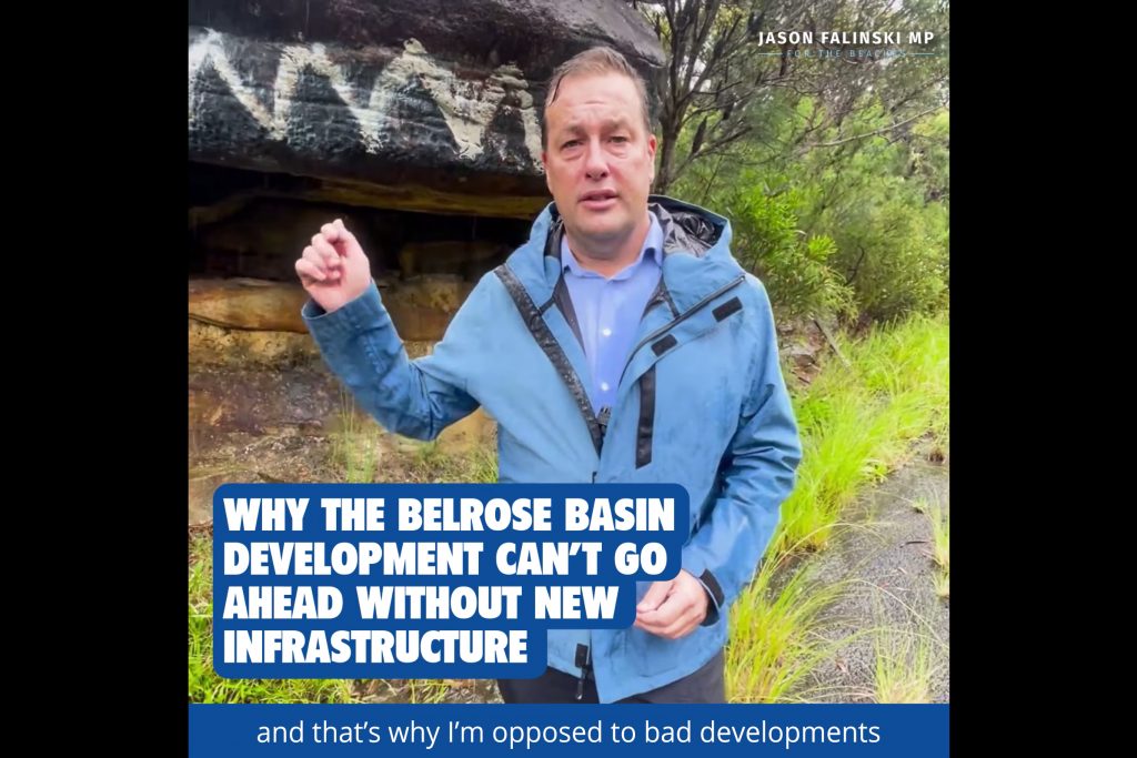
On 23 February, Jason Falinski MP, state member for Mackellar, lodged a post on Facebook requesting, “Don’t let the Belrose ‘Lizard Rock’ development go ahead without an upgrade in infrastructure on the Northern Beaches and a real plan to protect the local environment.”
In a video recorded at Lizard Rock, with an assertion that he’s opposed to “bad developments like this”, he declared: “The state government and the local council are planning to develop the Belrose Basin to put in hundreds of homes with thousands of cars. But there’s not a plan for more roads, better infrastructure, and how to maintain the character of this area.
“The problem with planning is this: people are happy to put more houses away from away from transport links and away from critical infrastructure, but the planners of this state refuse to put dwellings and homes around the metros and railway lines…”
Wildlife
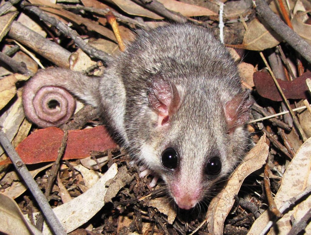
According to a 2 June 2017 report in the Daily Telegraph: “A council environment officer said ecological surveys were inadequate and studies paid for by the MLALC had shown more than 10 threatened species in the area, including the powerful owl and eastern pygmy possum.”
The fauna found in the vicinity that is most vulnerable under the New South Wales Threatened Species Conservation Act 1995, includes glossy black cockatoos, heath monitors, square-tailed kites, eastern bent-wing bats, grey-headed flying foxes, yellow-bellied sheath-tail bats and pygmy possums.
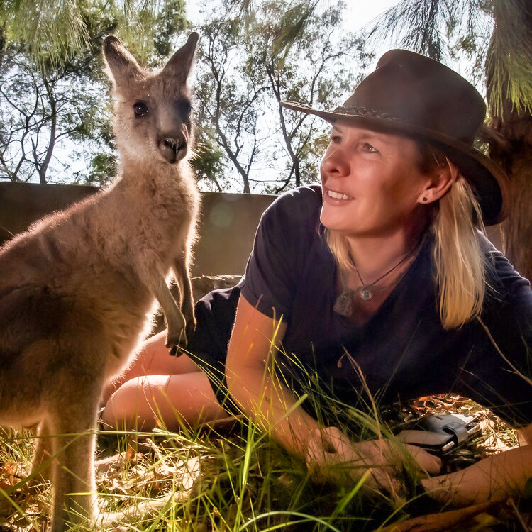
Georgie Campbell, a volunteer for Sydney Wildlife Rescue for 20 years, covers the Northern Beaches and French’s Forest/Belrose districts. She told Manly Observer, “I’m a very experienced wildlife handler, and I’m often called out to tend to native animals that have been hit by cars or attacked by cats and dogs. If we build more houses in this bushland, many different species will be displaced or killed as a result of human encroachment on their habitat.
“The first issue is habitat loss. For example, when the Northern Beaches Hospital was built, there were so many displaced animals, such as echidnas, possums, bandicoots, wombats and sugar gliders, that I was called out to deal with.
“The second-worst threat, in my opinion, is cat attack. New residents bring new pets that hunt and kill native animals. This is closely followed by car strike on busy roads, electrocution [on stock fences and overhead wires], dog attack and entrapment – such as a snake caught in vegetable netting.
“Every day I see how human activities impact on native wildlife. I just had to euthanise a green tree snake chewed up by a cat. I was recently called out to tend to a severely injured wallaby. I had to call the cops to shoot it because it was so badly hurt after being hit by a car, just 100 metres from Ralston Ave.”
Bushland adjacent to Ralston and Wyatt Avenues is where MLALC was granted 135.3 hectares in 2006. In 2013, Warringah Council rejected a housing development application there. In June 2017, Northern Beaches Council rejected another submission by MLALC to subdivide the land and build 169 residential lots.
MLALC’s submission has since been modified and is among the six sites currently targeted for new redevelopment.
Native habitat
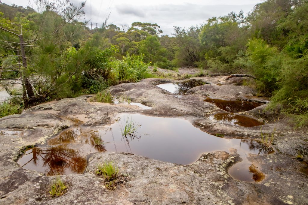
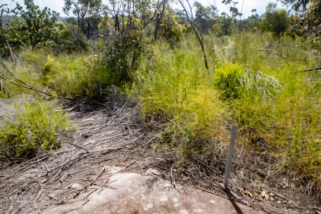
Several endangered ecological communities exist near one or more of the six regions earmarked for development. This includes coastal upland swamp at Red Hill Reserve in Oxford Falls.
According to the National Parks & Wildlife NSW, “Known threats to this community include habitat loss and habitat degradation from land clearing, fragmentation, weed invasion, dumping, inappropriate fire regimes and physical damage from inappropriate access and disturbance by people, horses, trail-bikes and other vehicles (resulting in deterioration of the tracks, soil erosion, nutrient enrichment and introduction of weeds).”
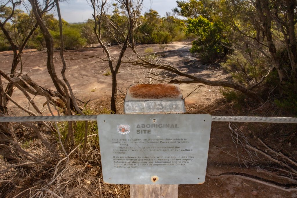
Photo: Alec Smart
Bushfires
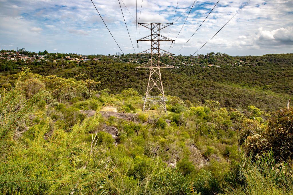
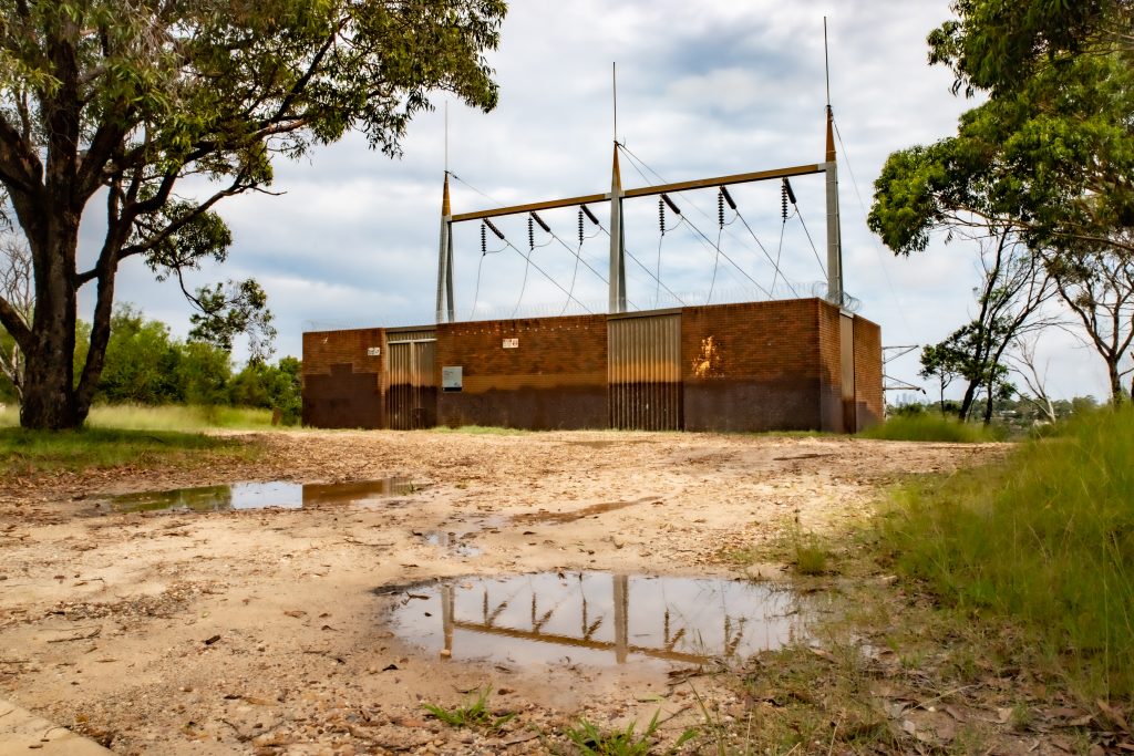
On 11 January 2018, one of the key reasons the Planning Assessment Commission (now the Independent Planning Commission) gave for rejecting MLALC and the Dept Planning and Environment’s 2014 request to rezone and develop land at the western end of Ralston Ave, Belrose, was its vulnerability to bushfires. This included the presence of overhead power lines and the location of Sydney East Substation at the end of the street adding significant risk of dangerous electrical discharges if consumed by fire.
The Commission’s report stated: “The subject land is located on a plateau at the crest of a ridge, with perimeters to the north, west and south comprised of gentle to steep sloping escarpments..
“The subject land is and surrounding area are designated as being Bushfire Prone on Council’s Bushfire Prone Land Map..”
Several of the six sites chosen for redevelopment in the MLALC-owned land are on ridges overlooking forested valleys.
Bushfires travel faster up hills, so houses atop a ridge are significantly more at risk than dwellings in the valley floor. According to the NSW Rural Fire Service, “a fire travelling uphill will travel faster. In fact, for every 10 degrees of slope, a fire can double its speed. As a fire speeds up, it becomes more intense and more dangerous.”
Fire moves faster uphill because there is less space between the flames and the new fuel to burn.
The report also revealed on 5 March 2018 the Commission met with TransGrid NSW, which operate and manage high voltage electricity transmission network in NSW and ACT, and learned “shutting down the substation can take up to four hours.”
High voltage power lines will arc during a bushfire, effectively sending dangerous jolts of electricity – between 66,000 to 500,000 volts – into the forests below, whilst posing a significant risk to evacuees or fire responders in the area.
The land adjacent to Lizard Rock in Belrose, the site MLALC and NSW Dept Planning hope will initiate the proposed land clearances and development schemes, is crossed by high voltage powerlines connected to a series of steel transmission towers.
Aboriginal carvings
At least one of the six sites targeted for urban development is very close to ancient Aboriginal rock carvings in Garigal National Park.
Indigenous engravings in the vicinity include: 12 moon carvings at Moon Rock in Ingleside; 116 mixed carvings on a rocky outcrop beside Engravings Track alongside Wakehurst Parkway, Killarney Heights; sea creatures and mundoes (footprints) in Cromer Heights; the Maiuolo Engravings at 226 Warringah Rd, Beacon Hill; and in Allambie Heights, three life-size figures and a flathead at the Gumbooya Reserve, and a kangaroo engraving nearby at Cootamundra Drive Reserve.
Building houses close to ancient Aboriginal engravings and artwork often results in desecration and vandalism. For example, 20 hand stencils discovered by archaeologists in July 2014 in a Northern Beaches’ cave had already been vandalised by heavy metal fans. ‘Metallica’ and ‘Guns n Roses’ band names and offensive drawings were spray-painted in black over the white ochre hand silhouettes, the latter estimated at up to 20,000 years old.
In February 2022, this reporter visited the Killarney Heights’ engravings, known as the Bantry Bay Aboriginal Site, where over 100 carvings, including fish, sea creatures, a wallaby, boomerangs, shields, a whale shark and a man are on an exposed sandstone rock plateau.
Possibly thousands of years old, they are situated less than 100 metres from the Bayview Close housing development in Frenchs Forest. This is a former MLALC-owned property that was sold to developers for up-market housing (where, less than five years later, the surrounding infrastructure of drains and kerbs are collapsing from what appears to be sub-standard concrete).
In Garigal National Park, between Bayview Close and the engravings, I discovered rubble and industrial plastic, apparently chucked into the bush by builders. At the engravings I found broken glass, discarded tobacco inhalers and a strange piece of plumbing scattered on the carved rocks.
Worse, some of the fencing enclosing the Indigenous site – the first discovered by Europeans, in 1788 – was torn down, which enabled access to off-road motorcycles. The carvings themselves, many faded and worn through centuries of weather erosion, were completely criss-crossed by motorcycle tracks.
There were even recently-carved drawings, crudely cut alongside what were undoubtedly important ceremonial symbols and narrative illustrations by the Garigal elders.
Luke Murphy, Administrator of the Northern Beach Aboriginal Land Community Discussion Group, told Manly Observer, “I respect Native Title, and I acknowledge the Aboriginal People as the original owners of the land we live in. I acknowledge that the MLALC now owns the land we are talking about. Any question of ownership of the land was settled in 1983.
“But I would object to ANY development, not just this development. Our only chance of ensuring a good outcome is to make sure the developers are accountable for the outcome. On past performance, if Bayview Cl Frenchs Forest is an indication of what we can expect in future, this development should not go ahead. NSW Government must ensure that there are appropriate checks and balances in place to ensure that the current owners i.e., the MLALC, are responsible and accountable for the ultimate outcome of this process.”

The Aboriginal Heritage Office, based in Freshwater and custodians of Sydney’s Indigenous sites, artworks and engravings, told Manly Observer, “The AHO is aware of the planning issues. As the Aboriginal Heritage Office is a partnership of Councils, we provide advice to those Councils when they refer things to us.
“While we can’t comment publicly, we would recommend doing some careful background research when looking at issues around land that has been ‘won back’ through the NSW Aboriginal Land Rights Act 1983…”
Solution?
The proposed urbanisation of the six MLALC-owned bushland sites around Belrose, Frenchs Forest and Oxford Falls has generated thousands of comments in the online community groups facilitating discussion of the highly contentious schemes.
However, a compromise solution suggested among many opponents is for the NSW Govt to buy or lease the land from MLALC, and preserve it for eternity as undeveloped native bushland.
On 25 February, Save Manly Dam Bushland suggested “Much of this designated land was originally mooted, by the Metropolitan Local Aboriginal Land Council, to become an extension to Garigal National Park (linking the Hawkesbury to the Harbour). The state government then appeared unwilling to allocate the required funding for that vision to be realised.
“This could now be a wonderful opportunity to revisit that proposal and conserve natural and cultural heritage. Alternatively, irreplaceable landscapes could be lost to concrete forever.
“The proposal would provide permanent environmental protection for a large area of over 1000ha of Narrabeen Lagoon Catchment and annual lease payments to MLALC from the Government for the lands owned by them (or potential land purchase).”
A Department of Planning and Environment spokesperson told Manly Observer, “The Northern Beaches Aboriginal Land Development Delivery Plan (DDP), which is currently on exhibition, is the first step in considering the management of the Metropolitan Local Aboriginal Land Council’s (MLALC) land in the Northern Beaches LGA.
“Any application to change planning rules on any of the sites, including Lizard Rock, would need to consider all environmental and heritage impacts, and be subject to community consultation. All submissions, including any received from the NSW National Parks and Wildlife Service, will be carefully considered following the exhibition period.”
Summary of the NSW Govt’s proposals
Map of the six sites
The NSW Govt draft Northern Beaches Aboriginal Land Development Delivery Plan is available to view online. Public comment is welcome until Mon 21 March 2022.
MLALC were contacted for this article and asked: “one of the recent suggestions gaining currency among those who oppose any urbanisation of the MLALC-owned tracts of land, is whether NSW Govt should buy or lease the land from MLALC, instead of permitting its development.
“This would still raise vital funds for Aboriginal communities, but preserve the forests facing development.
What is MLALC’s response; is it a viable solution, or at least open to negotiation?”
MLALC CEO Nathan Moran replied, “We are pleased to be working closely with Minister Roberts and the Department of Planning. This is an extremely positive step towards utilising our land to deliver economic outcomes for our community as envisaged by the Aboriginal Land Rights Act.
“Given the NSW Government’s Department of Planning, Industry and Environment is leading the delivery of this DDP, may I please suggest you forward any specific queries relating to the Development Delivery Plan to the Department of Planning.”
—————————————————–
A community rally in opposition to the proposed land redevelopments is taking place at 2pm on Sunday 13 March at the Ralston Bush Tracks, Cnr Ralston Ave and Elm Ave, Belrose.
